 vesseltracker.com
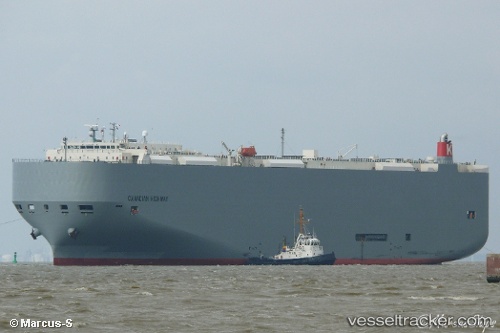
 Canadian Highway
Current Status
Where is the vessel?
Canadian Highway is currently in 103 nm E of Ruby, based on AIS data received less than 1h ago.
Latest AIS update:
Current position: 9.86557° N, 110.15387° E (103 nm E of Ruby)
Average speed (last 7 days): Loading…
Average speed (last 30 days): Loading…
Vessel profile: Canadian Highway is a Vehicles Carrier with dimensions 199m x 32m.
This page combines live AIS, route history, probable destination signals, nearby traffic, and port activity for practical vessel monitoring.
The current position of vessel Canadian Highway is 9.86557 lat / 110.15387 lng. Updated: 2026-04-02 05:55:47 UTCNearest reference points:
- 156 nm SE of Phan Rang-Tháp Chàm
- Near Rang Dong
- 163 nm E of Vinh Cam Ranh
Currently sailing under the flag of Panama ![]()
Canadian Highway built in 2010 year
Deadweight:
18581 tDetails:
Live Vessel Canadian Highway Analytics (details, animations, etc.)
Recent AIS points (UTC):
2026-04-01 23:56:17 UTC · 8.60239, 109.07184 · SOG 16.7 kn · COG 43°2026-04-02 02:26:16 UTC · 9.11322, 109.55840 · SOG 16.7 kn · COG 39°
2026-04-02 03:31:17 UTC · 9.33703, 109.74965 · SOG 16.5 kn · COG 44°
2026-04-02 05:55:47 UTC · 9.86557, 110.15387 · SOG 16.2 kn · COG 33°