 vesseltracker.com
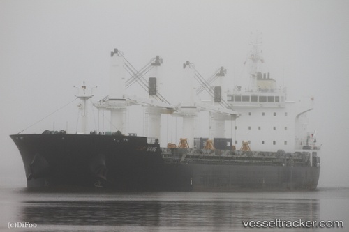
 SAILBOARD
Current Status
Where is the vessel?
SAILBOARD is currently in Near Lingkas, based on AIS data received about 12h ago.
Latest AIS update:
Current position: 3.38451° N, 117.50805° E (Near Lingkas)
Average speed (last 7 days): Loading…
Average speed (last 30 days): Loading…
Vessel profile: SAILBOARD is a Bulk Carrier with dimensions m x m.
This page combines live AIS, route history, probable destination signals, nearby traffic, and port activity for practical vessel monitoring.
The current position of vessel SAILBOARD is 3.38451 lat / 117.50805 lng. Updated: 2026-04-27 06:53:49 UTCNearest reference points:
- Near Lingkas
- 43 nm E of Sibuko Bay
- Near Muara Pantai
Currently sailing under the flag of Marshall Islands ![]()
Details:
Live Vessel SAILBOARD Analytics (details, animations, etc.)
Recent AIS points (UTC):
2026-04-27 06:53:49 UTC · 3.38451, 117.50805 · SOG 2.6 kn · COG 91°2026-04-27 06:53:49 UTC · 3.38451, 117.50805 · SOG 2.6 kn · COG 91°
2026-04-27 06:53:49 UTC · 3.38451, 117.50805 · SOG 2.6 kn · COG 91°
2026-04-27 06:53:49 UTC · 3.38451, 117.50805 · SOG 2.6 kn · COG 91°