 vesseltracker.com
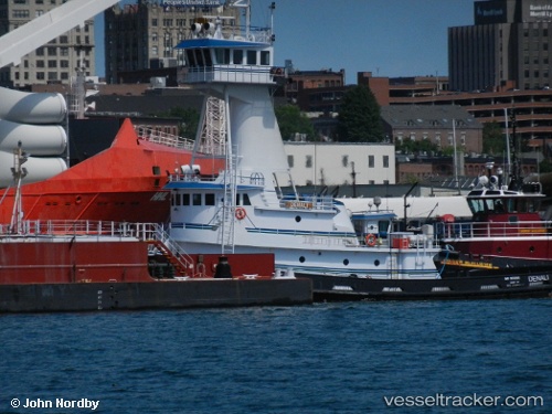
 Denali
Current Status
Where is the vessel?
Denali is currently in Near Tenants Harbour, based on AIS data received less than 1h ago.
Latest AIS update:
Current position: 43.93248° N, 69.13877° W (Near Tenants Harbour)
Average speed (last 7 days): Loading…
Average speed (last 30 days): Loading…
Vessel profile: Denali is a Tug with dimensions 152m x 24m.
This page combines live AIS, route history, probable destination signals, nearby traffic, and port activity for practical vessel monitoring.
The current position of vessel Denali is 43.93248 lat / -69.13877 lng. Updated: 2026-05-12 22:16:53 UTCNearest reference points:
- Near ROCKPORT
- Near Harpswell Center
- Near Surry
Currently sailing under the flag of USA ![]()
Denali built in 2010 year
Deadweight:
278 tDetails:
Live Vessel Denali Analytics (details, animations, etc.)
Recent AIS points (UTC):
2026-05-12 19:30:43 UTC · 43.65963, -69.49523 · SOG 8.7 kn · COG 32°2026-05-12 19:43:03 UTC · 43.68417, -69.47186 · SOG 8.8 kn · COG 32°
2026-05-12 22:04:23 UTC · 43.92706, -69.16609 · SOG 2.4 kn · COG 65°
2026-05-12 22:16:53 UTC · 43.93248, -69.13877 · SOG 7.1 kn · COG 72°