 vesseltracker.com
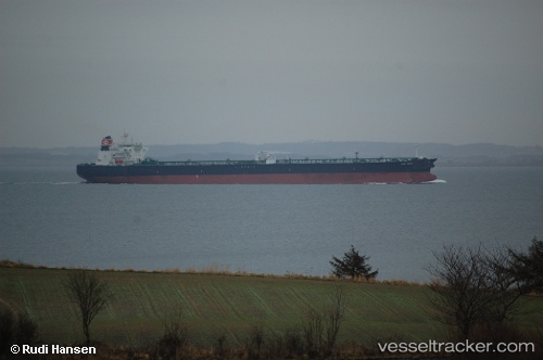
San Saba
Current StatusWhere is the vessel?
San Saba is currently in Near Milford Haven, based on AIS data received less than 1h ago.
Latest AIS update:
Current position: 51.69799° N, 5.04224° W (Near Milford Haven)
Average speed (last 7 days): Loading…
Average speed (last 30 days): Loading…
Vessel profile: San Saba is a Crude Oil Tanker with dimensions 48m x 274m.
This page combines live AIS, route history, probable destination signals, nearby traffic, and port activity for practical vessel monitoring.
The current position of vessel San Saba is 51.69799 lat / -5.04224 lng. Updated: 2026-05-14 22:20:29 UTCNearest reference points:
- Near Black Pill
- Near Landore
- 10 nm NW of Grampound
Details:
Live Vessel San Saba Analytics (details, animations, etc.)
Recent AIS points (UTC):
2026-05-14 18:08:28 UTC · 51.69798, -5.04226 · SOG 0 kn · COG 88°2026-05-14 19:08:28 UTC · 51.69799, -5.04228 · SOG 0 kn · COG 88°
2026-05-14 19:50:24 UTC · 51.69801, -5.04227 · SOG 0 kn · COG 88°
2026-05-14 22:20:29 UTC · 51.69799, -5.04224 · SOG 0 kn · COG 88°