 vesseltracker.com
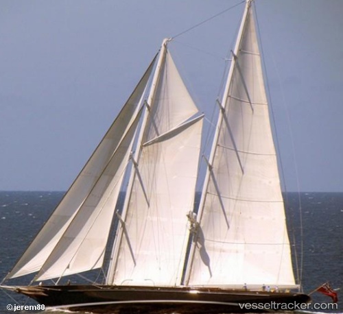
Marie
Current StatusWhere is the vessel?
Marie is currently in Near Newport, based on AIS data received less than 1h ago.
Latest AIS update:
Current position: 41.48960° N, 71.32346° W (Near Newport)
Average speed (last 7 days): Loading…
Average speed (last 30 days): Loading…
Vessel profile: Marie is a Service Ship with dimensions 11m x 56m.
This page combines live AIS, route history, probable destination signals, nearby traffic, and port activity for practical vessel monitoring.
The current position of vessel Marie is 41.48960 lat / -71.32346 lng. Updated: 2026-05-14 18:04:41 UTCNearest reference points:
- Near Newport
- Near MELVILLE
- Near DAVISVILLE
Details:
Live Vessel Marie Analytics (details, animations, etc.)
Recent AIS points (UTC):
2026-05-14 14:13:40 UTC · 41.48960, -71.32346 · SOG 0 kn · COG 354°2026-05-14 16:19:39 UTC · 41.48960, -71.32348 · SOG 0 kn · COG 355°
2026-05-14 16:49:41 UTC · 41.48960, -71.32347 · SOG 0 kn · COG 355°
2026-05-14 18:04:41 UTC · 41.48960, -71.32346 · SOG 0 kn · COG 354°