 vesseltracker.com
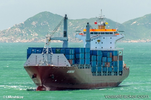
 SONGA DOLPHIN
Current Status
Where is the vessel?
SONGA DOLPHIN is currently in 55 nm E of Mahahual, based on AIS data received less than 1h ago.
Latest AIS update:
Current position: 18.67667° N, 86.72500° W (55 nm E of Mahahual)
Average speed (last 7 days): Loading…
Average speed (last 30 days): Loading…
Vessel profile: SONGA DOLPHIN is a Container Ship with dimensions m x m.
This page combines live AIS, route history, probable destination signals, nearby traffic, and port activity for practical vessel monitoring.
The current position of vessel SONGA DOLPHIN is 18.67667 lat / -86.72500 lng. Updated: 2026-05-02 16:43:01 UTCNearest reference points:
- 14 nm SE of Belize
- 26 nm SE of Dangriga
- 12 nm SW of Dangriga
Currently sailing under the flag of Marshall Islands ![]()
Details:
Live Vessel SONGA DOLPHIN Analytics (details, animations, etc.)
Recent AIS points (UTC):
2026-05-02 13:28:01 UTC · 17.86667, -87.04667 · SOG 15 kn · COG -1°2026-05-02 13:37:00 UTC · 17.90333, -87.03167 · SOG 15 kn · COG -1°
2026-05-02 16:07:00 UTC · 18.52500, -86.78667 · SOG 16 kn · COG -1°
2026-05-02 16:43:01 UTC · 18.67667, -86.72500 · SOG 16 kn · COG -1°