 vesseltracker.com
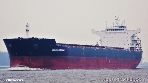
 HONG G
Current Status
Where is the vessel?
HONG G is currently in 18 nm SW of Gibraltar, based on AIS data received less than 1h ago.
Latest AIS update:
Current position: 35.98667° N, 6.67333° W (18 nm SW of Gibraltar)
Average speed (last 7 days): Loading…
Average speed (last 30 days): Loading…
Vessel profile: HONG G is a Bulk Carrier with dimensions 229m x 229m.
This page combines live AIS, route history, probable destination signals, nearby traffic, and port activity for practical vessel monitoring.
The current position of vessel HONG G is 35.98667 lat / -6.67333 lng. Updated: 2026-05-13 04:01:04 UTCNearest reference points:
- Near Gibraltar
- Near Conil de la Frontera
- 45 nm W of Gibraltar
Currently sailing under the flag of Liberia ![]()
HONG G built in 2012 year
Deadweight:
93025 tDetails:
Live Vessel HONG G Analytics (details, animations, etc.)
Recent AIS points (UTC):
2026-05-13 01:07:25 UTC · 36.12435, -7.29193 · SOG 10.9 kn · COG 103°2026-05-13 02:29:34 UTC · 36.05914, -6.99719 · SOG 10.9 kn · COG 104°
2026-05-13 03:22:03 UTC · 36.01667, -6.81000 · SOG 10 kn · COG -1°
2026-05-13 04:01:04 UTC · 35.98667, -6.67333 · SOG 10 kn · COG -1°