 vesseltracker.com
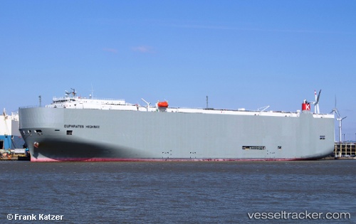
 Euphrates Highway
Current Status
Where is the vessel?
Euphrates Highway is currently in 344 nm NE of Wake Island, based on AIS data received less than 1h ago.
Latest AIS update:
Current position: 23.53181° N, 170.73927° E (344 nm NE of Wake Island)
Average speed (last 7 days): Loading…
Average speed (last 30 days): Loading…
Vessel profile: Euphrates Highway is a Vehicles Carrier with dimensions 199m x 199m.
This page combines live AIS, route history, probable destination signals, nearby traffic, and port activity for practical vessel monitoring.
The current position of vessel Euphrates Highway is 23.53181 lat / 170.73927 lng. Updated: 2026-05-16 13:58:58 UTCNearest reference points:
- Open sea, approx. 401 nm off the nearest listed port
- Open sea, approx. 404 nm off the nearest listed port
- Open sea, approx. 407 nm off the nearest listed port
Currently sailing under the flag of Panama ![]()
Euphrates Highway built in 2012 year
Deadweight:
18668 tDetails:
Live Vessel Euphrates Highway Analytics (details, animations, etc.)
Recent AIS points (UTC):
2026-05-16 10:20:53 UTC · 23.29763, 171.94672 · SOG 18.1 kn · COG 281°2026-05-16 11:38:15 UTC · 23.37324, 171.52853 · SOG 18.4 kn · COG 283°
2026-05-16 13:08:40 UTC · 23.47577, 171.02621 · SOG 18.9 kn · COG 283°
2026-05-16 13:58:58 UTC · 23.53181, 170.73927 · SOG 19.4 kn · COG 283°