 vesseltracker.com
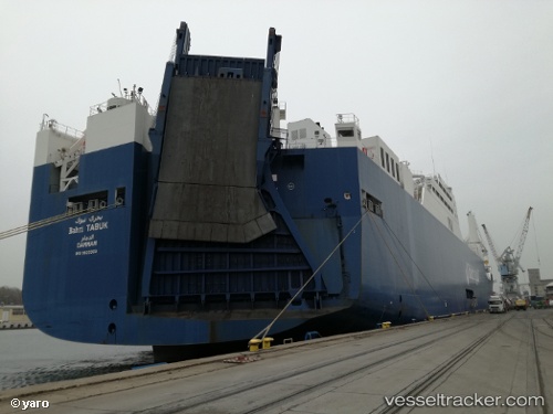
 Bahri Tabuk
Current Status
Where is the vessel?
Bahri Tabuk is currently in Open sea, approx. 413 nm off the nearest listed port, based on AIS data received less than 1h ago.
Latest AIS update:
Current position: 32.63571° S, 9.37663° E (Open sea, approx. 413 nm off the nearest listed port)
Average speed (last 7 days): Loading…
Average speed (last 30 days): Loading…
Vessel profile: Bahri Tabuk is a Ro Ro Cargo Ship with dimensions 223m x 32m.
This page combines live AIS, route history, probable destination signals, nearby traffic, and port activity for practical vessel monitoring.
The current position of vessel Bahri Tabuk is -32.63571 lat / 9.37663 lng. Updated: 2026-05-15 21:40:35 UTCNearest reference points:
- Open sea, approx. 413 nm off the nearest listed port
- Open sea, approx. 414 nm off the nearest listed port
- Open sea, approx. 415 nm off the nearest listed port
Currently sailing under the flag of Saudi Arabia ![]()
Bahri Tabuk built in 2013 year
Deadweight:
25957 tDetails:
Live Vessel Bahri Tabuk Analytics (details, animations, etc.)
Recent AIS points (UTC):
2026-05-15 17:50:11 UTC · -32.88111, 10.45417 · SOG 14.3 kn · COG 286°2026-05-15 19:11:12 UTC · -32.79095, 10.07573 · SOG 14.7 kn · COG 285°
2026-05-15 19:52:16 UTC · -32.74461, 9.88376 · SOG 14.6 kn · COG 286°
2026-05-15 21:40:35 UTC · -32.63571, 9.37663 · SOG 14.7 kn · COG 284°