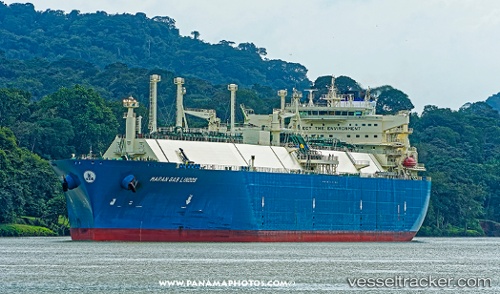
.
Vessel photo of Maran Gas Lindos (IMO 9627502) vesseltracker.com

GR flag Maran Gas Lindos

Vessel type: Lng Tanker | IMO: 9627502 | MMSI: MMSI: 241351000
Call sign: SVCB7 | Dimensions: 294 m x 44 m
Current Status

Where is the vessel?

Maran Gas Lindos is currently in 159 nm NW of Lombrum, based on AIS data received less than 1h ago.

Latest AIS update:

Current position: 0.67744° S, 145.08713° E (159 nm NW of Lombrum)

Average speed (last 7 days): Loading…

Average speed (last 30 days): Loading…

Vessel profile: Maran Gas Lindos is a Lng Tanker with dimensions 294m x 44m.

This page combines live AIS, route history, probable destination signals, nearby traffic, and port activity for practical vessel monitoring.

The current position of vessel Maran Gas Lindos is -0.67744 lat / 145.08713 lng. Updated: 2026-04-01 05:41:11 UTC
Nearest reference points:
  • 132 nm N of Lombrum

Currently sailing under the flag of Greece GR flag

Details:

Live Vessel Maran Gas Lindos Analytics (details, animations, etc.)


Recent AIS points (UTC):
2026-04-01 00:03:22 UTC · -2.04903, 145.46713 · SOG 15.7 kn · COG 350°
2026-04-01 02:08:13 UTC · -1.49471, 145.40543 · SOG 16.2 kn · COG 353°
2026-04-01 03:51:54 UTC · -1.07089, 145.29121 · SOG 14.5 kn · COG 330°
2026-04-01 05:41:11 UTC · -0.67744, 145.08713 · SOG 14.5 kn · COG 328°

Track of the vessel in the last 60 days


UTC: --
Start: -- Track timeline (UTC) End: --
Encountered: --


Link to the map:


Find another ship

Maran_Gas_Lindos (241351000) last ports (portcalls and passsages)

Tuas | 2025-09-14 11:41:22
Tuas | 2025-09-08 11:06:16
JURONG ISLAND | 2025-09-04 05:45:30
BUKOM ISLAND | 2025-09-03 08:46:59
TANAH MERAH | 2025-08-29 07:25:48
PULAU SAMBU | 2025-08-29 06:47:01
BUKOM ISLAND | 2025-08-27 17:06:09
Assaluyeh | 2025-08-16 21:15:40
RAS LAFFAN | 2025-08-15 22:50:32
BUKOM ISLAND | 2025-07-24 18:06:01
RAS LAFFAN | 2025-07-02 05:08:32
ASALUYEH | 2025-07-01 21:09:46
Assaluyeh | 2025-07-01 17:54:15
DHAMRA | 2025-06-20 20:02:21
RAS LAFFAN | 2025-06-06 10:20:32
BUKOM ISLAND | 2025-05-27 04:00:41
TANAH MERAH | 2025-05-27 02:48:33
PENGERANG | 2025-05-27 02:11:22
PENGERANG | 2025-05-11 17:30:32
TANAH MERAH | 2025-05-11 17:14:41
RAS LAFFAN | 2025-05-01 13:27:01
RAS LAFFAN | 2025-04-01 06:35:34
DHAMRA | 2025-03-19 01:41:22
RAS LAFFAN | 2025-03-06 08:28:32
DHAMRA | 2025-02-19 01:58:28
Das Island | 2025-02-08 19:35:17
PULAU SAMBU | 2025-01-26 06:30:46
TANAH MERAH | 2025-01-26 05:24:57
ZHOUSHAN | 2025-01-17 05:04:05
PULAU SAMBU | 2025-01-07 20:41:11
RAS LAFFAN | 2024-12-28 08:26:04
BUKOM ISLAND | 2024-12-13 18:06:35
JURONG ISLAND | 2024-12-13 17:14:52
Sint Nicolaashaven | 2024-11-15 22:31:24
Oranjestad | 2024-11-15 20:10:10
SABINE PASS | 2024-11-07 19:58:07
Singapore | 2024-06-28 05:02:38
Map Ta Phut | 2024-06-24 23:05:42
Singapore | 2024-05-26 20:05:14
Zeebrugge | 2024-01-22 19:03:52
Aliaga | 2023-12-11 18:13:09
Nemrut Bay | 2023-12-11 15:18:05
Kalamai | 2023-12-07 05:26:36
Strait Of Gibraltar | 2023-12-04 01:24:19
St. Nazaire | 2023-11-11 13:35:46
Zeebrugge | 2023-10-18 06:21:29
Dampier | 2023-02-23 08:28:38
Sambu | 2022-11-21 02:15:31
Ra’S Shukhayr | 2022-10-20 01:39:57
Bur Ibrahim | 2022-10-19 17:02:32
Port Said | 2022-10-19 04:09:38
Milford Haven | 2022-10-08 10:15:43
Bur Ibrahim | 2022-09-29 04:13:39
Mutrah | 2022-08-24 07:45:25
Selat Wetar | 2022-06-04 07:30:03
Yokohama | 2022-05-24 01:55:44
Yokosuka | 2022-05-22 22:47:37
Gladstone Harbor | 2022-03-04 06:00:21
Thursday Island | 2022-02-28 07:57:55
Yokkaichi | 2022-01-26 01:45:02
Gladstone Harbor | 2022-01-12 12:15:29
Sambu | 2021-12-23 20:05:38
Singapore | 2021-12-23 19:40:19
Sambu | 2021-12-23 19:35:10
Singapore | 2021-12-21 07:50:11
Singapore | 2021-12-21 07:10:09
Sambu | 2021-12-21 06:55:41
Selat Wetar | 2021-12-05 20:18:18