 vesseltracker.com
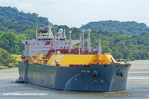
 Kita Lng
Current Status
Where is the vessel?
Kita Lng is currently in 166 nm SW of Okha, based on AIS data received less than 1h ago.
Latest AIS update:
Current position: 20.87728° N, 66.65002° E (166 nm SW of Okha)
Average speed (last 7 days): Loading…
Average speed (last 30 days): Loading…
Vessel profile: Kita Lng is a Lng Tanker with dimensions 294m x 294m.
This page combines live AIS, route history, probable destination signals, nearby traffic, and port activity for practical vessel monitoring.
The current position of vessel Kita Lng is 20.87728 lat / 66.65002 lng. Updated: 2026-04-01 23:21:27 UTCNearest reference points:
- 231 nm SW of Keti Bandar
- 49 nm S of Positra
- 54 nm S of Positra
Currently sailing under the flag of Malta ![]()
Details:
Live Vessel Kita Lng Analytics (details, animations, etc.)
Recent AIS points (UTC):
2026-04-01 17:29:53 UTC · 20.62570, 66.58082 · SOG 11.9 kn · COG 189°2026-04-01 20:12:03 UTC · 20.90755, 66.55961 · SOG 11.4 kn · COG 10°
2026-04-01 22:14:52 UTC · 21.09025, 66.65054 · SOG 11.3 kn · COG -1°
2026-04-01 23:21:27 UTC · 20.87728, 66.65002 · SOG 11.3 kn · COG 182°