 vesseltracker.com
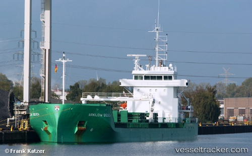
 Arklow Beach
Current Status
Where is the vessel?
Arklow Beach is currently in Near Saint-Palais-sur-Mer, based on AIS data received less than 1h ago.
Latest AIS update:
Current position: 45.63222° N, 1.11269° W (Near Saint-Palais-sur-Mer)
Average speed (last 7 days): Loading…
Average speed (last 30 days): Loading…
Vessel profile: Arklow Beach is a General Cargo Ship with dimensions 119m x 15m.
This page combines live AIS, route history, probable destination signals, nearby traffic, and port activity for practical vessel monitoring.
The current position of vessel Arklow Beach is 45.63222 lat / -1.11269 lng. Updated: 2026-05-12 20:06:16 UTCNearest reference points:
- Near Royan
- Near LE VERDON-SUR-MER
- Near Saint-Pierre-d'Oléron
Currently sailing under the flag of Netherlands ![]()
Arklow Beach built in 2014 year
Deadweight:
8400 tDetails:
Live Vessel Arklow Beach Analytics (details, animations, etc.)
Recent AIS points (UTC):
2026-05-12 16:18:47 UTC · 45.59193, -1.46433 · SOG 0.1 kn · COG 17°2026-05-12 17:58:59 UTC · 45.59210, -1.46483 · SOG 0.1 kn · COG 36°
2026-05-12 19:14:20 UTC · 45.62163, -1.33064 · SOG 10.9 kn · COG 59°
2026-05-12 20:06:16 UTC · 45.63222, -1.11269 · SOG 12.3 kn · COG 130°