 vesseltracker.com
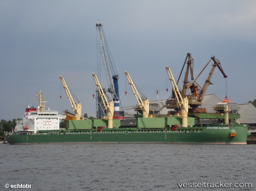
 Strategic Alliance
Current Status
Where is the vessel?
Strategic Alliance is currently in Near DOS BOCAS, based on AIS data received about 2h ago.
Latest AIS update:
Current position: 18.43334° N, 93.20214° W (Near DOS BOCAS)
Average speed (last 7 days): Loading…
Average speed (last 30 days): Loading…
Vessel profile: Strategic Alliance is a Bulk Carrier with dimensions 180m x 30m.
This page combines live AIS, route history, probable destination signals, nearby traffic, and port activity for practical vessel monitoring.
The current position of vessel Strategic Alliance is 18.43334 lat / -93.20214 lng. Updated: 2026-03-26 21:40:31 UTCNearest reference points:
- 35 nm S of Yùum K'Ak'Náab
- 18 nm S of Yùum K'Ak'Náab
- Near Coatzacoalcos
Currently sailing under the flag of Singapore ![]()
Strategic Alliance built in 2014 year
Deadweight:
39848 tDetails:
Live Vessel Strategic Alliance Analytics (details, animations, etc.)
Recent AIS points (UTC):
2026-03-26 15:55:56 UTC · 18.43330, -93.20211 · SOG 0 kn · COG 33°2026-03-26 17:43:59 UTC · 18.43332, -93.20213 · SOG 0 kn · COG 32°
2026-03-26 19:34:33 UTC · 18.43335, -93.20217 · SOG 0 kn · COG 33°
2026-03-26 21:40:31 UTC · 18.43334, -93.20214 · SOG 0 kn · COG 33°