 vesseltracker.com
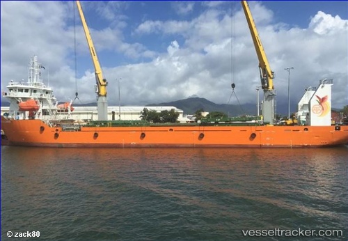
Fly Alliance
Current StatusWhere is the vessel?
Fly Alliance is currently in Near Motukea Island, based on AIS data received less than 1h ago.
Latest AIS update:
Current position: 9.42666° S, 147.10333° E (Near Motukea Island)
Average speed (last 7 days): Loading…
Average speed (last 30 days): Loading…
Vessel profile: Fly Alliance is a Container Ship with dimensions 19m x 91m.
This page combines live AIS, route history, probable destination signals, nearby traffic, and port activity for practical vessel monitoring.
The current position of vessel Fly Alliance is -9.42666 lat / 147.10333 lng. Updated: 2026-04-24 03:32:55 UTCDetails:
Live Vessel Fly Alliance Analytics (details, animations, etc.)
Recent AIS points (UTC):
2026-04-24 00:13:07 UTC · -9.42800, 147.10335 · SOG 0 kn · COG 107°2026-04-24 02:07:09 UTC · -9.42804, 147.10352 · SOG 0 kn · COG 106°
2026-04-24 02:20:53 UTC · -9.42666, 147.10333 · SOG 0 kn · COG -1°
2026-04-24 03:32:55 UTC · -9.42666, 147.10333 · SOG 0 kn · COG -1°