 vesseltracker.com
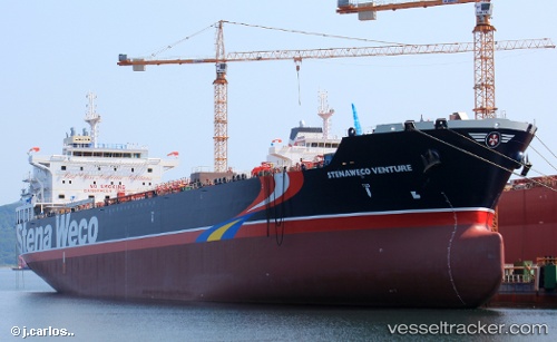
 OCEAN VENTURE
Current Status
Where is the vessel?
OCEAN VENTURE is currently in Near VONDELINGENPLAAT - ROTTERDAM, based on AIS data received less than 1h ago.
Latest AIS update:
Current position: 51.89699° N, 4.35810° E (Near VONDELINGENPLAAT - ROTTERDAM)
Average speed (last 7 days): Loading…
Average speed (last 30 days): Loading…
Vessel profile: OCEAN VENTURE is a Oil/Chemical Tanker with dimensions m x m.
This page combines live AIS, route history, probable destination signals, nearby traffic, and port activity for practical vessel monitoring.
The current position of vessel OCEAN VENTURE is 51.89699 lat / 4.35810 lng. Updated: 2026-05-12 22:25:21 UTCNearest reference points:
- Near VONDELINGENPLAAT - ROTTERDAM
- Near VLAARDINGEN - ROTTERDAM
- Near Pernis
Currently sailing under the flag of Portugal ![]()
Details:
Live Vessel OCEAN VENTURE Analytics (details, animations, etc.)
Recent AIS points (UTC):
2026-05-12 19:22:20 UTC · 51.89699, 4.35820 · SOG 0 kn · COG 255°2026-05-12 19:58:22 UTC · 51.89701, 4.35815 · SOG 0 kn · COG 255°
2026-05-12 21:52:20 UTC · 51.89701, 4.35815 · SOG 0.1 kn · COG 255°
2026-05-12 22:25:21 UTC · 51.89699, 4.35810 · SOG 0 kn · COG 255°