 vesseltracker.com
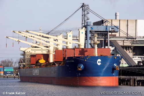
Clipper Kythira
Current StatusWhere is the vessel?
Clipper Kythira is currently in 66 nm N of Attu Island, based on AIS data received about 1h ago.
Latest AIS update:
Current position: 54.03833° N, 173.66499° E (66 nm N of Attu Island)
Average speed (last 7 days): Loading…
Average speed (last 30 days): Loading…
Vessel profile: Clipper Kythira is a Bulk Carrier with dimensions 32m x 200m.
This page combines live AIS, route history, probable destination signals, nearby traffic, and port activity for practical vessel monitoring.
The current position of vessel Clipper Kythira is 54.03833 lat / 173.66499 lng. Updated: 2026-04-03 03:48:26 UTCNearest reference points:
- 57 nm SW of Zagorow
Details:
Live Vessel Clipper Kythira Analytics (details, animations, etc.)
Recent AIS points (UTC):
2026-04-02 22:03:25 UTC · 54.05833, 175.18167 · SOG 9 kn · COG -1°2026-04-02 23:45:17 UTC · 54.04167, 174.74481 · SOG 9 kn · COG 264°
2026-04-03 01:50:48 UTC · 54.04455, 174.19083 · SOG 9.6 kn · COG 270°
2026-04-03 03:48:26 UTC · 54.03833, 173.66499 · SOG 9 kn · COG -1°