 vesseltracker.com
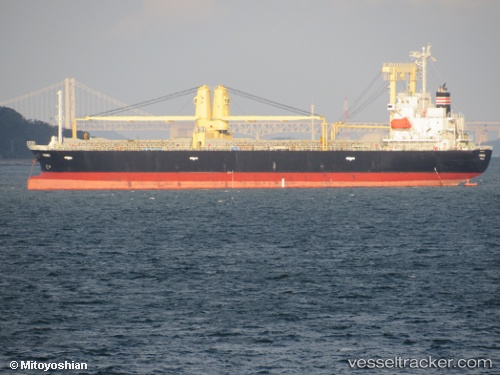
Nanbu
Current StatusWhere is the vessel?
Nanbu is currently in Near Pulau Indah, based on AIS data received less than 1h ago.
Latest AIS update:
Current position: 2.79664° N, 101.32492° E (Near Pulau Indah)
Average speed (last 7 days): Loading…
Average speed (last 30 days): Loading…
Vessel profile: Nanbu is a General Cargo Ship with dimensions 19m x 131m.
This page combines live AIS, route history, probable destination signals, nearby traffic, and port activity for practical vessel monitoring.
The current position of vessel Nanbu is 2.79664 lat / 101.32492 lng. Updated: 2026-05-17 19:44:22 UTCNearest reference points:
- Near Pulau Indah
- Near Carey Island Estate
- Near Banting
Details:
Live Vessel Nanbu Analytics (details, animations, etc.)
Recent AIS points (UTC):
2026-05-17 16:23:22 UTC · 2.79677, 101.32495 · SOG 0 kn · COG 108°2026-05-17 18:17:22 UTC · 2.79690, 101.32488 · SOG 0.2 kn · COG 111°
2026-05-17 19:14:22 UTC · 2.79691, 101.32500 · SOG 0.1 kn · COG 107°
2026-05-17 19:44:22 UTC · 2.79664, 101.32492 · SOG 0 kn · COG 95°