 vesseltracker.com
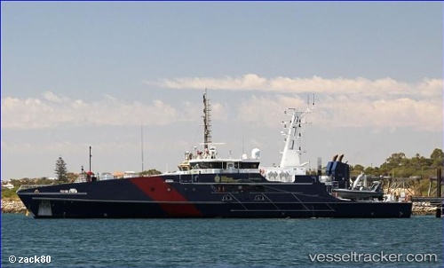
Border Force Cutter
Current StatusWhere is the vessel?
Border Force Cutter is currently in Near East Arm, based on AIS data received less than 1h ago.
Latest AIS update:
Current position: 12.48757° S, 130.87704° E (Near East Arm)
Average speed (last 7 days): Loading…
Average speed (last 30 days): Loading…
Vessel profile: Border Force Cutter is a Patrol Vessel with dimensions 11m x 59m.
This page combines live AIS, route history, probable destination signals, nearby traffic, and port activity for practical vessel monitoring.
The current position of vessel Border Force Cutter is -12.48757 lat / 130.87704 lng. Updated: 2026-05-16 13:21:23 UTCNearest reference points:
- Near Palmerston
- Near Winnellie
Details:
Live Vessel Border Force Cutter Analytics (details, animations, etc.)
Recent AIS points (UTC):
2026-05-16 09:24:23 UTC · -12.48758, 130.87704 · SOG 0 kn · COG 127°2026-05-16 10:42:23 UTC · -12.48758, 130.87704 · SOG 0 kn · COG 127°
2026-05-16 12:09:23 UTC · -12.48757, 130.87704 · SOG 0 kn · COG 126°
2026-05-16 13:21:23 UTC · -12.48757, 130.87704 · SOG 0 kn · COG 126°