 vesseltracker.com
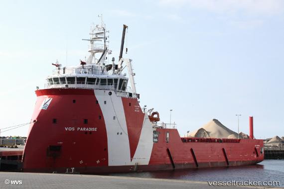
 ENERGY PARADISE
Current Status
Where is the vessel?
ENERGY PARADISE is currently in Near Town Quays/Drogheda, based on AIS data received less than 1h ago.
Latest AIS update:
Current position: 53.68448° N, 6.36060° E (Near Town Quays/Drogheda)
Average speed (last 7 days): Loading…
Average speed (last 30 days): Loading…
Vessel profile: ENERGY PARADISE is a Other Type with dimensions m x m.
This page combines live AIS, route history, probable destination signals, nearby traffic, and port activity for practical vessel monitoring.
The current position of vessel ENERGY PARADISE is 53.68448 lat / 6.36060 lng. Updated: 2026-05-16 14:07:32 UTCNearest reference points:
- 14 nm NW of Town Quays/Drogheda
- Near Borkum
- Near Hoogkerk
Currently sailing under the flag of Norway ![]()
Details:
Live Vessel ENERGY PARADISE Analytics (details, animations, etc.)
Recent AIS points (UTC):
2026-05-16 10:03:02 UTC · 53.67465, 6.36303 · SOG 0.3 kn · COG 258°2026-05-16 12:23:21 UTC · 53.67558, 6.36518 · SOG 0.3 kn · COG 281°
2026-05-16 14:00:51 UTC · 53.68448, 6.36174 · SOG 0.5 kn · COG 99°
2026-05-16 14:07:32 UTC · 53.68448, 6.36060 · SOG 0.4 kn · COG 99°