 vesseltracker.com
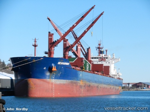
 SEAHARMONY
Current Status
Where is the vessel?
SEAHARMONY is currently in 76 nm N of Camacha, based on AIS data received less than 1h ago.
Latest AIS update:
Current position: 34.33833° N, 16.56167° W (76 nm N of Camacha)
Average speed (last 7 days): Loading…
Average speed (last 30 days): Loading…
Vessel profile: SEAHARMONY is a Bulk Carrier with dimensions 199m x 32m.
This page combines live AIS, route history, probable destination signals, nearby traffic, and port activity for practical vessel monitoring.
The current position of vessel SEAHARMONY is 34.33833 lat / -16.56167 lng. Updated: 2026-05-16 12:04:45 UTCNearest reference points:
- 78 nm W of Nedroma
- 109 nm E of Porto Santo Island
Currently sailing under the flag of Malta ![]()
SEAHARMONY built in 2015 year
Deadweight:
62770 tDetails:
Live Vessel SEAHARMONY Analytics (details, animations, etc.)
Recent AIS points (UTC):
2026-05-16 07:46:45 UTC · 35.08667, -16.06167 · SOG 12 kn · COG -1°2026-05-16 10:04:46 UTC · 34.68333, -16.33500 · SOG 11 kn · COG -1°
2026-05-16 10:07:46 UTC · 34.67333, -16.34166 · SOG 11 kn · COG -1°
2026-05-16 12:04:45 UTC · 34.33833, -16.56167 · SOG 11 kn · COG -1°