 vesseltracker.com
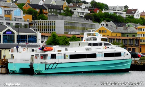
 Terningen
Current Status
Where is the vessel?
Terningen is currently in Near FLORVAG, based on AIS data received about 1h ago.
Latest AIS update:
Current position: 60.40659° N, 5.22770° E (Near FLORVAG)
Average speed (last 7 days): Loading…
Average speed (last 30 days): Loading…
Vessel profile: Terningen is a Passenger Ship with dimensions 41m x 11m.
This page combines live AIS, route history, probable destination signals, nearby traffic, and port activity for practical vessel monitoring.
The current position of vessel Terningen is 60.40659 lat / 5.22770 lng. Updated: 2026-05-14 08:26:11 UTCNearest reference points:
- Near Skålevik
- Near Bergen
- Near Hakonsvern
Currently sailing under the flag of Norway ![]()
Terningen built in 2014 year
Details:
Live Vessel Terningen Analytics (details, animations, etc.)
Recent AIS points (UTC):
2026-05-14 04:32:08 UTC · 60.40658, 5.22769 · SOG 0 kn · COG 331°2026-05-14 05:47:05 UTC · 60.40660, 5.22769 · SOG 0 kn · COG 331°
2026-05-14 08:01:14 UTC · 60.40657, 5.22767 · SOG 0 kn · COG 331°
2026-05-14 08:26:11 UTC · 60.40659, 5.22770 · SOG 0 kn · COG 331°