 vesseltracker.com
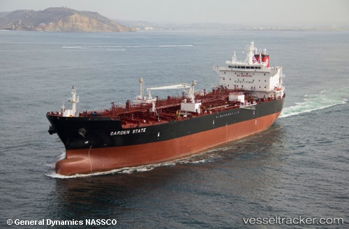
Garden State
Current StatusWhere is the vessel?
Garden State is currently in Near Tampa, based on AIS data received about 1h ago.
Latest AIS update:
Current position: 27.91067° N, 82.42956° W (Near Tampa)
Average speed (last 7 days): Loading…
Average speed (last 30 days): Loading…
Vessel profile: Garden State is a Chemical Oil Products Tanker with dimensions 32m x 186m.
This page combines live AIS, route history, probable destination signals, nearby traffic, and port activity for practical vessel monitoring.
The current position of vessel Garden State is 27.91067 lat / -82.42956 lng. Updated: 2026-05-13 01:52:10 UTCNearest reference points:
- Near Tampa
- Near St. Petersburg
- Near Saint Petersburg
Details:
Live Vessel Garden State Analytics (details, animations, etc.)
Recent AIS points (UTC):
2026-05-12 22:32:05 UTC · 27.90965, -82.42950 · SOG 0.6 kn · COG 89°2026-05-13 00:01:34 UTC · 27.91071, -82.42955 · SOG 0 kn · COG 214°
2026-05-13 01:01:10 UTC · 27.91068, -82.42957 · SOG 0 kn · COG 214°
2026-05-13 01:52:10 UTC · 27.91067, -82.42956 · SOG 0 kn · COG 214°