 vesseltracker.com
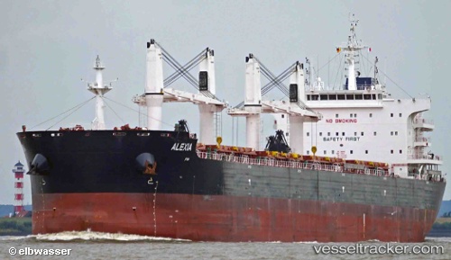
 Alexia
Current Status
Where is the vessel?
Alexia is currently in 342 nm SE of Abakaliki, based on AIS data received about 2h ago.
Latest AIS update:
Current position: 1.19386° N, 88.47621° E (342 nm SE of Abakaliki)
Average speed (last 7 days): Loading…
Average speed (last 30 days): Loading…
Vessel profile: Alexia is a Bulk Carrier with dimensions 200m x 32m.
This page combines live AIS, route history, probable destination signals, nearby traffic, and port activity for practical vessel monitoring.
The current position of vessel Alexia is 1.19386 lat / 88.47621 lng. Updated: 2026-05-16 08:05:13 UTCNearest reference points:
- Open sea, approx. 401 nm off the nearest listed port
- Open sea, approx. 400 nm off the nearest listed port
- Open sea, approx. 402 nm off the nearest listed port
Currently sailing under the flag of Malta ![]()
Details:
Live Vessel Alexia Analytics (details, animations, etc.)
Recent AIS points (UTC):
2026-05-16 04:18:04 UTC · 0.74285, 87.94543 · SOG 10.9 kn · COG 39°2026-05-16 05:55:14 UTC · 0.93467, 88.17386 · SOG 11.2 kn · COG 40°
2026-05-16 08:00:24 UTC · 1.18462, 88.46509 · SOG 10.8 kn · COG 44°
2026-05-16 08:05:13 UTC · 1.19386, 88.47621 · SOG 10.8 kn · COG 45°