 vesseltracker.com
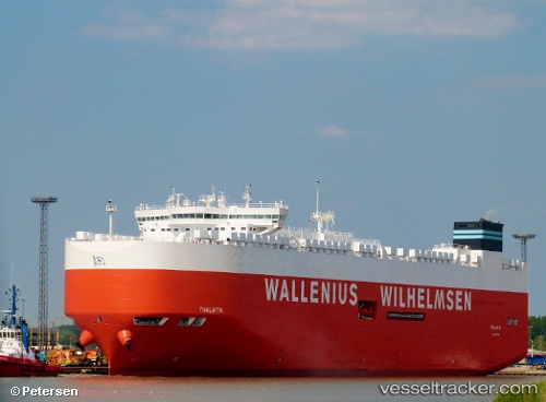
 Thalatta
Current Status
Where is the vessel?
Thalatta is currently in 66 nm S of Svenica, based on AIS data received about 1h ago.
Latest AIS update:
Current position: 44.98667° N, 152.86166° E (66 nm S of Svenica)
Average speed (last 7 days): Loading…
Average speed (last 30 days): Loading…
Vessel profile: Thalatta is a Vehicles Carrier with dimensions 200m x 37m.
This page combines live AIS, route history, probable destination signals, nearby traffic, and port activity for practical vessel monitoring.
The current position of vessel Thalatta is 44.98667 lat / 152.86166 lng. Updated: 2026-05-13 07:24:32 UTCCurrently sailing under the flag of Malta ![]()
Details:
Live Vessel Thalatta Analytics (details, animations, etc.)
Recent AIS points (UTC):
2026-05-13 04:24:42 UTC · 45.49898, 153.66029 · SOG 14.8 kn · COG 228°2026-05-13 04:56:01 UTC · 45.41239, 153.52444 · SOG 14.7 kn · COG 227°
2026-05-13 06:18:58 UTC · 45.17836, 153.16052 · SOG 15.3 kn · COG 227°
2026-05-13 07:24:32 UTC · 44.98667, 152.86166 · SOG 15 kn · COG -1°