 vesseltracker.com
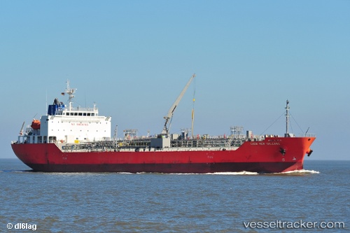
Chem New Orleans
Current StatusWhere is the vessel?
Chem New Orleans is currently in 87 nm NW of Benahavis, based on AIS data received less than 1h ago.
Latest AIS update:
Current position: 37.69879° N, 51.54215° W (87 nm NW of Benahavis)
Average speed (last 7 days): Loading…
Average speed (last 30 days): Loading…
Vessel profile: Chem New Orleans is a Chemical Oil Products Tanker with dimensions 24m x 145m.
This page combines live AIS, route history, probable destination signals, nearby traffic, and port activity for practical vessel monitoring.
The current position of vessel Chem New Orleans is 37.69879 lat / -51.54215 lng. Updated: 2026-05-15 21:27:45 UTCNearest reference points:
- 76 nm SW of Seica
- 44 nm SE of Jonesville
- 153 nm S of Jonesville
Details:
Live Vessel Chem New Orleans Analytics (details, animations, etc.)
Recent AIS points (UTC):
2026-05-15 17:00:28 UTC · 37.35874, -52.77594 · SOG 13.8 kn · COG 69°2026-05-15 19:42:46 UTC · 37.55654, -52.01770 · SOG 14.3 kn · COG 68°
2026-05-15 20:13:54 UTC · 37.60326, -51.87704 · SOG 13.9 kn · COG 68°
2026-05-15 21:27:45 UTC · 37.69879, -51.54215 · SOG 13.7 kn · COG 73°