 vesseltracker.com
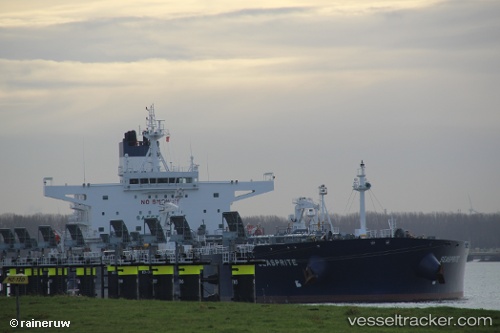
Seasprite
Current StatusWhere is the vessel?
Seasprite is currently in 136 nm S of Chapineria, based on AIS data received less than 1h ago.
Latest AIS update:
Current position: 38.13501° N, 41.60086° W (136 nm S of Chapineria)
Average speed (last 7 days): Loading…
Average speed (last 30 days): Loading…
Vessel profile: Seasprite is a Crude Oil Tanker with dimensions 44m x 250m.
This page combines live AIS, route history, probable destination signals, nearby traffic, and port activity for practical vessel monitoring.
The current position of vessel Seasprite is 38.13501 lat / -41.60086 lng. Updated: 2026-05-15 13:13:57 UTCNearest reference points:
- 97 nm SE of Chapineria
- 47 nm W of Eureka Springs
Details:
Live Vessel Seasprite Analytics (details, animations, etc.)
Recent AIS points (UTC):
2026-05-15 09:39:03 UTC · 38.14008, -42.50501 · SOG 10.9 kn · COG 94°2026-05-15 10:41:07 UTC · 38.13613, -42.25543 · SOG 12 kn · COG 95°
2026-05-15 11:59:57 UTC · 38.13550, -41.92000 · SOG 12 kn · COG 90°
2026-05-15 13:13:57 UTC · 38.13501, -41.60086 · SOG 12.4 kn · COG 88°