 vesseltracker.com
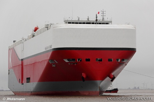
Hawaiian Highway
Current StatusWhere is the vessel?
Hawaiian Highway is currently in 97 nm SE of West Ocean City, based on AIS data received less than 1h ago.
Latest AIS update:
Current position: 37.59833° N, 73.26667° W (97 nm SE of West Ocean City)
Average speed (last 7 days): Loading…
Average speed (last 30 days): Loading…
Vessel profile: Hawaiian Highway is a Vehicles Carrier with dimensions 40m x 199m.
This page combines live AIS, route history, probable destination signals, nearby traffic, and port activity for practical vessel monitoring.
The current position of vessel Hawaiian Highway is 37.59833 lat / -73.26667 lng. Updated: 2026-05-13 10:23:07 UTCNearest reference points:
- 57 nm E of Fenwick Island
- 24 nm E of West Ocean City
- 48 nm E of Nags Head
Details:
Live Vessel Hawaiian Highway Analytics (details, animations, etc.)
Recent AIS points (UTC):
2026-05-13 04:52:00 UTC · 36.01593, -74.22454 · SOG 18.5 kn · COG 28°2026-05-13 06:28:29 UTC · 36.47009, -73.95260 · SOG 19.2 kn · COG 25°
2026-05-13 09:40:22 UTC · 37.41645, -73.39137 · SOG 18.1 kn · COG 31°
2026-05-13 10:23:07 UTC · 37.59833, -73.26667 · SOG 14 kn · COG -1°