 vesseltracker.com
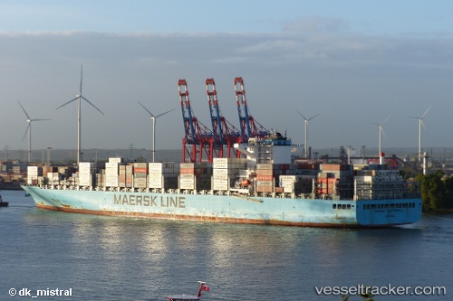
 MAERSK GUATEMALA
Current Status
Where is the vessel?
MAERSK GUATEMALA is currently in 14 nm SE of HELGOLAND, based on AIS data received about 1h ago.
Latest AIS update:
Current position: 54.00721° N, 8.17281° E (14 nm SE of HELGOLAND)
Average speed (last 7 days): Loading…
Average speed (last 30 days): Loading…
Vessel profile: MAERSK GUATEMALA is a Cargo A with dimensions m x m.
This page combines live AIS, route history, probable destination signals, nearby traffic, and port activity for practical vessel monitoring.
The current position of vessel MAERSK GUATEMALA is 54.00721 lat / 8.17281 lng. Updated: 2026-05-17 11:45:16 UTCNearest reference points:
- 10 nm E of Wangerooge
- Near Wangerooge
- Near HOOKSIEL
Currently sailing under the flag of Singapore ![]()
Details:
Live Vessel MAERSK GUATEMALA Analytics (details, animations, etc.)
Recent AIS points (UTC):
2026-05-17 08:16:25 UTC · 53.78599, 9.38735 · SOG 16.2 kn · COG 340°2026-05-17 10:11:10 UTC · 53.86671, 8.72954 · SOG 10.7 kn · COG 318°
2026-05-17 10:56:35 UTC · 53.97368, 8.50386 · SOG 16 kn · COG 281°
2026-05-17 11:45:16 UTC · 54.00721, 8.17281 · SOG 14.9 kn · COG 269°