 vesseltracker.com
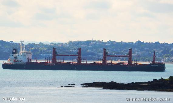
Hanyang
Current StatusWhere is the vessel?
Hanyang is currently in 32 nm S of Anglesea, based on AIS data received less than 1h ago.
Latest AIS update:
Current position: 38.94963° S, 144.21211° E (32 nm S of Anglesea)
Average speed (last 7 days): Loading…
Average speed (last 30 days): Loading…
Vessel profile: Hanyang is a Bulk Carrier with dimensions 30m x 180m.
This page combines live AIS, route history, probable destination signals, nearby traffic, and port activity for practical vessel monitoring.
The current position of vessel Hanyang is -38.94963 lat / 144.21211 lng. Updated: 2026-05-15 10:10:54 UTCNearest reference points:
- Near QUEENSCLIFF
- Near Geelong North
- Near Drysdale
Details:
Live Vessel Hanyang Analytics (details, animations, etc.)
Recent AIS points (UTC):
2026-05-15 07:16:21 UTC · -38.95805, 144.23012 · SOG 0.2 kn · COG 350°2026-05-15 08:09:30 UTC · -38.95453, 144.22726 · SOG 0.2 kn · COG 346°
2026-05-15 09:36:20 UTC · -38.95084, 144.21790 · SOG 0.4 kn · COG 338°
2026-05-15 10:10:54 UTC · -38.94963, 144.21211 · SOG 0.5 kn · COG 341°