 vesseltracker.com
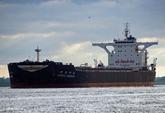
 China Harmony
Current Status
Where is the vessel?
China Harmony is currently in 64 nm NE of Pagerungan, based on AIS data received about 2h ago.
Latest AIS update:
Current position: 6.24973° S, 116.74438° E (64 nm NE of Pagerungan)
Average speed (last 7 days): Loading…
Average speed (last 30 days): Loading…
Vessel profile: China Harmony is a Bulk Carrier with dimensions 295m x 46m.
This page combines live AIS, route history, probable destination signals, nearby traffic, and port activity for practical vessel monitoring.
The current position of vessel China Harmony is -6.24973 lat / 116.74438 lng. Updated: 2026-05-17 19:11:20 UTCNearest reference points:
- 74 nm NE of Pagerungan
- 37 nm E of Pagerungan
- 117 nm W of Panakukang
Currently sailing under the flag of Hong Kong ![]()
Details:
Live Vessel China Harmony Analytics (details, animations, etc.)
Recent AIS points (UTC):
2026-05-17 16:16:37 UTC · -5.68175, 116.96732 · SOG 12.6 kn · COG 206°2026-05-17 16:16:37 UTC · -5.68175, 116.96732 · SOG 12.6 kn · COG 206°
2026-05-17 19:11:20 UTC · -6.24973, 116.74438 · SOG 12.5 kn · COG 203°
2026-05-17 19:11:20 UTC · -6.24973, 116.74438 · SOG 12.5 kn · COG 203°