 vesseltracker.com
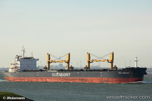
 CLIPPER IRIS
Current Status
Where is the vessel?
CLIPPER IRIS is currently in 13 nm NE of Qala, based on AIS data received less than 1h ago.
Latest AIS update:
Current position: 36.14782° N, 14.51548° E (13 nm NE of Qala)
Average speed (last 7 days): Loading…
Average speed (last 30 days): Loading…
Vessel profile: CLIPPER IRIS is a Cargo with dimensions m x m.
This page combines live AIS, route history, probable destination signals, nearby traffic, and port activity for practical vessel monitoring.
The current position of vessel CLIPPER IRIS is 36.14782 lat / 14.51548 lng. Updated: 2026-05-16 14:06:07 UTCNearest reference points:
- Near Saint Julians
- Near Xghajra
- Near MARSAMXETT
Currently sailing under the flag of Marshall Islands ![]()
Details:
Live Vessel CLIPPER IRIS Analytics (details, animations, etc.)
Recent AIS points (UTC):
2026-05-16 10:05:20 UTC · 36.14261, 14.42230 · SOG 1.3 kn · COG 254°2026-05-16 12:21:09 UTC · 36.08687, 14.41510 · SOG 1.6 kn · COG 253°
2026-05-16 14:01:39 UTC · 36.14429, 14.50169 · SOG 9.5 kn · COG 70°
2026-05-16 14:06:07 UTC · 36.14782, 14.51548 · SOG 9.5 kn · COG 77°