 vesseltracker.com
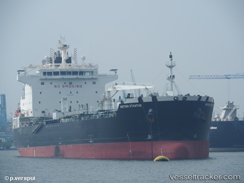
 SEA STRATUS
Current Status
Where is the vessel?
SEA STRATUS is currently in 17 nm W of de Ruyter, based on AIS data received about 1h ago.
Latest AIS update:
Current position: 52.23175° N, 3.60088° E (17 nm W of de Ruyter)
Average speed (last 7 days): Loading…
Average speed (last 30 days): Loading…
Vessel profile: SEA STRATUS is a Chemical/Oil Products Tanker with dimensions 183m x 32m.
This page combines live AIS, route history, probable destination signals, nearby traffic, and port activity for practical vessel monitoring.
The current position of vessel SEA STRATUS is 52.23175 lat / 3.60088 lng. Updated: 2026-05-16 13:52:27 UTCNearest reference points:
- 12 nm NE of Hunsdon
- Near Haarlemmermeer
- Near de Ruyter
Currently sailing under the flag of Marshall Islands ![]()
SEA STRATUS built in 2017 year
Deadweight:
39999 tDetails:
Live Vessel SEA STRATUS Analytics (details, animations, etc.)
Recent AIS points (UTC):
2026-05-16 10:02:28 UTC · 52.22861, 3.59779 · SOG 0 kn · COG 311°2026-05-16 12:18:37 UTC · 52.23129, 3.60111 · SOG 0.1 kn · COG 241°
2026-05-16 13:52:27 UTC · 52.23175, 3.60088 · SOG 0 kn · COG 229°
2026-05-16 13:52:27 UTC · 52.23175, 3.60088 · SOG 0 kn · COG 229°