 vesseltracker.com
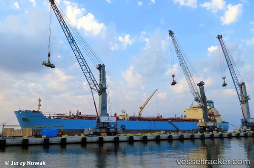
Maersk Teesport
Current StatusWhere is the vessel?
Maersk Teesport is currently in Near Port Arthur, based on AIS data received about 1h ago.
Latest AIS update:
Current position: 29.83252° N, 93.96502° W (Near Port Arthur)
Average speed (last 7 days): Loading…
Average speed (last 30 days): Loading…
Vessel profile: Maersk Teesport is a Chemical Oil Products Tanker with dimensions 32m x 183m.
This page combines live AIS, route history, probable destination signals, nearby traffic, and port activity for practical vessel monitoring.
The current position of vessel Maersk Teesport is 29.83252 lat / -93.96502 lng. Updated: 2026-03-29 12:04:26 UTCNearest reference points:
- Near SABINE PASS
- 10 nm W of Sabine Pass
- Near Atreco
Details:
Live Vessel Maersk Teesport Analytics (details, animations, etc.)
Recent AIS points (UTC):
2026-03-29 05:22:11 UTC · 29.83252, -93.96500 · SOG 0 kn · COG 125°2026-03-29 08:16:10 UTC · 29.83251, -93.96501 · SOG 0 kn · COG 125°
2026-03-29 10:19:12 UTC · 29.83252, -93.96503 · SOG 0 kn · COG 125°
2026-03-29 12:04:26 UTC · 29.83252, -93.96502 · SOG 0 kn · COG 125°