 vesseltracker.com
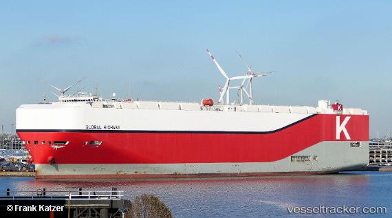
 Global Highway
Current Status
Where is the vessel?
Global Highway is currently in 396 nm NE of Port Mathurin, based on AIS data received about 1h ago.
Latest AIS update:
Current position: 15.64269° S, 68.89239° E (396 nm NE of Port Mathurin)
Average speed (last 7 days): Loading…
Average speed (last 30 days): Loading…
Vessel profile: Global Highway is a Vehicles Carrier with dimensions 199m x 199m.
This page combines live AIS, route history, probable destination signals, nearby traffic, and port activity for practical vessel monitoring.
The current position of vessel Global Highway is -15.64269 lat / 68.89239 lng. Updated: 2026-05-12 20:17:13 UTCNearest reference points:
- Open sea, approx. 401 nm off the nearest listed port
- Open sea, approx. 402 nm off the nearest listed port
- Open sea, approx. 403 nm off the nearest listed port
Currently sailing under the flag of Panama ![]()
Details:
Live Vessel Global Highway Analytics (details, animations, etc.)
Recent AIS points (UTC):
2026-05-12 16:17:11 UTC · -15.04167, 69.89667 · SOG 17 kn · COG -1°2026-05-12 18:23:05 UTC · -15.35333, 69.36833 · SOG 17 kn · COG -1°
2026-05-12 19:50:04 UTC · -15.57333, 69.00500 · SOG 16 kn · COG -1°
2026-05-12 20:17:13 UTC · -15.64269, 68.89239 · SOG 17.3 kn · COG 235°