 vesseltracker.com
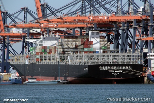
Cape Kortia
Current StatusWhere is the vessel?
Cape Kortia is currently in Near La Spezia, based on AIS data received about 1h ago.
Latest AIS update:
Current position: 44.10651° N, 9.84371° E (Near La Spezia)
Average speed (last 7 days): Loading…
Average speed (last 30 days): Loading…
Vessel profile: Cape Kortia is a Container Ship with dimensions 48m x 330m.
This page combines live AIS, route history, probable destination signals, nearby traffic, and port activity for practical vessel monitoring.
The current position of vessel Cape Kortia is 44.10651 lat / 9.84371 lng. Updated: 2026-05-16 07:40:18 UTCNearest reference points:
- Near La Spezia
- Near Ortonova, Isola
- Near Vernazza
Details:
Live Vessel Cape Kortia Analytics (details, animations, etc.)
Recent AIS points (UTC):
2026-05-16 04:04:18 UTC · 44.10653, 9.84374 · SOG 0 kn · COG 179°2026-05-16 05:31:19 UTC · 44.10653, 9.84371 · SOG 0 kn · COG 179°
2026-05-16 07:28:18 UTC · 44.10652, 9.84370 · SOG 0 kn · COG 179°
2026-05-16 07:40:18 UTC · 44.10651, 9.84371 · SOG 0 kn · COG 179°