 vesseltracker.com
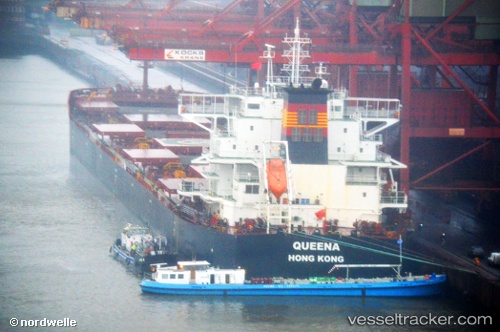
 QUEENA
Current Status
Where is the vessel?
QUEENA is currently in Near Thetis Island, based on AIS data received less than 1h ago.
Latest AIS update:
Current position: 49.03108° N, 123.64350° W (Near Thetis Island)
Average speed (last 7 days): Loading…
Average speed (last 30 days): Loading…
Vessel profile: QUEENA is a Cargo with dimensions m x m.
This page combines live AIS, route history, probable destination signals, nearby traffic, and port activity for practical vessel monitoring.
The current position of vessel QUEENA is 49.03108 lat / -123.64350 lng. Updated: 2026-05-02 16:22:14 UTCNearest reference points:
- Near Cassidy
- Near Harmac
- Near Nanaimo
Currently sailing under the flag of Marshall Islands ![]()
Details:
Live Vessel QUEENA Analytics (details, animations, etc.)
Recent AIS points (UTC):
2026-05-02 13:49:36 UTC · 49.03090, -123.64400 · SOG 0 kn · COG 324°2026-05-02 14:22:20 UTC · 49.03112, -123.64340 · SOG 0 kn · COG 317°
2026-05-02 15:48:32 UTC · 49.03110, -123.64300 · SOG 0 kn · COG 317°
2026-05-02 16:22:14 UTC · 49.03108, -123.64350 · SOG 0 kn · COG 318°