 vesseltracker.com
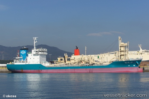
 Tatsumi Maru No.2
Current Status
Where is the vessel?
Tatsumi Maru No.2 is currently in Near KANDA, based on AIS data received less than 1h ago.
Latest AIS update:
Current position: 33.80573° N, 131.07217° E (Near KANDA)
Average speed (last 7 days): Loading…
Average speed (last 30 days): Loading…
Vessel profile: Tatsumi Maru No.2 is a Cement Carrier with dimensions 94m x 16m.
This page combines live AIS, route history, probable destination signals, nearby traffic, and port activity for practical vessel monitoring.
The current position of vessel Tatsumi Maru No.2 is 33.80573 lat / 131.07217 lng. Updated: 2026-05-16 16:25:42 UTCNearest reference points:
- Near KANDA
- Near Ube
- Near Shimonoseki
Currently sailing under the flag of Japan ![]()
Details:
Live Vessel Tatsumi Maru No.2 Analytics (details, animations, etc.)
Recent AIS points (UTC):
2026-05-16 11:55:41 UTC · 33.80595, 131.07060 · SOG 0 kn · COG 73°2026-05-16 13:19:50 UTC · 33.80594, 131.07233 · SOG 0 kn · COG 278°
2026-05-16 14:13:45 UTC · 33.80571, 131.07217 · SOG 0 kn · COG 299°
2026-05-16 16:25:42 UTC · 33.80573, 131.07217 · SOG 0 kn · COG 296°