 vesseltracker.com
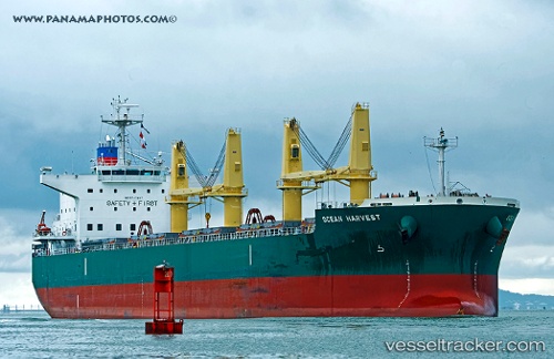
Ocean Harvest
Current StatusWhere is the vessel?
Ocean Harvest is currently in Near Pilottown, based on AIS data received less than 1h ago.
Latest AIS update:
Current position: 29.25707° N, 89.32766° W (Near Pilottown)
Average speed (last 7 days): Loading…
Average speed (last 30 days): Loading…
Vessel profile: Ocean Harvest is a Bulk Carrier with dimensions 32m x 190m.
This page combines live AIS, route history, probable destination signals, nearby traffic, and port activity for practical vessel monitoring.
The current position of vessel Ocean Harvest is 29.25707 lat / -89.32766 lng. Updated: 2026-04-24 20:01:32 UTCNearest reference points:
- Near Pilottown
- 13 nm NE of Pilottown
- 11 nm NE of Port Sulphur
Details:
Live Vessel Ocean Harvest Analytics (details, animations, etc.)
Recent AIS points (UTC):
2026-04-24 16:47:24 UTC · 29.60924, -89.87685 · SOG 6.9 kn · COG 116°2026-04-24 18:17:03 UTC · 29.43631, -89.59982 · SOG 11.8 kn · COG 199°
2026-04-24 19:33:52 UTC · 29.32897, -89.38749 · SOG 12.9 kn · COG 141°
2026-04-24 20:01:32 UTC · 29.25707, -89.32766 · SOG 11 kn · COG 128°