 vesseltracker.com
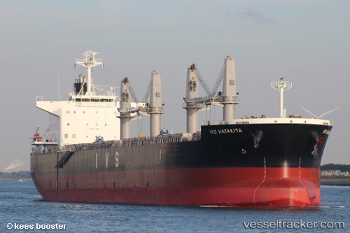
 IOANNIS
Current Status
Where is the vessel?
IOANNIS is currently in Near Hunsdon, based on AIS data received less than 1h ago.
Latest AIS update:
Current position: 51.74199° N, 3.25407° E (Near Hunsdon)
Average speed (last 7 days): Loading…
Average speed (last 30 days): Loading…
Vessel profile: IOANNIS is a Cargo with dimensions m x m.
This page combines live AIS, route history, probable destination signals, nearby traffic, and port activity for practical vessel monitoring.
The current position of vessel IOANNIS is 51.74199 lat / 3.25407 lng. Updated: 2026-04-25 14:18:47 UTCNearest reference points:
- Near Hunsdon
- Near Thorntonbank
- 12 nm NE of Hunsdon
Currently sailing under the flag of Malta ![]()
Details:
Live Vessel IOANNIS Analytics (details, animations, etc.)
Recent AIS points (UTC):
2026-04-25 10:48:24 UTC · 51.82588, 3.33845 · SOG 0.1 kn · COG 223°2026-04-25 12:09:26 UTC · 51.82462, 3.33954 · SOG 0.2 kn · COG 258°
2026-04-25 13:34:47 UTC · 51.81133, 3.31214 · SOG 5.8 kn · COG 221°
2026-04-25 14:18:47 UTC · 51.74199, 3.25407 · SOG 10.6 kn · COG 199°