 vesseltracker.com
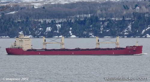
 FEDERAL RUHR
Current Status
Where is the vessel?
FEDERAL RUHR is currently in Near Marchwood, based on AIS data received about 1h ago.
Latest AIS update:
Current position: 50.90712° N, 1.43666° W (Near Marchwood)
Average speed (last 7 days): Loading…
Average speed (last 30 days): Loading…
Vessel profile: FEDERAL RUHR is a Bulk Carrier with dimensions 24m x 200m.
This page combines live AIS, route history, probable destination signals, nearby traffic, and port activity for practical vessel monitoring.
The current position of vessel FEDERAL RUHR is 50.90712 lat / -1.43666 lng. Updated: 2026-05-13 23:29:58 UTCNearest reference points:
- Near Southampton
- Near MERCURY
- Near PORT HAMBLE
Currently sailing under the flag of Marshall Islands ![]()
FEDERAL RUHR built in 2017 year
Deadweight:
36754 tDetails:
Live Vessel FEDERAL RUHR Analytics (details, animations, etc.)
Recent AIS points (UTC):
2026-05-13 19:38:59 UTC · 50.90713, -1.43663 · SOG 0 kn · COG 118°2026-05-13 22:08:58 UTC · 50.90709, -1.43662 · SOG 0 kn · COG 118°
2026-05-13 22:14:59 UTC · 50.90712, -1.43654 · SOG 0 kn · COG 118°
2026-05-13 23:29:58 UTC · 50.90712, -1.43666 · SOG 0 kn · COG 118°