 vesseltracker.com
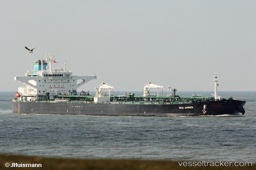
 Sea Amber
Current Status
Where is the vessel?
Sea Amber is currently in 11 nm NW of Verzy, based on AIS data received about 13h ago.
Latest AIS update:
Current position: 49.29534° N, 4.32489° W (11 nm NW of Verzy)
Average speed (last 7 days): Loading…
Average speed (last 30 days): Loading…
Vessel profile: Sea Amber is a Crude Oil Tanker with dimensions 274m x 48m.
This page combines live AIS, route history, probable destination signals, nearby traffic, and port activity for practical vessel monitoring.
The current position of vessel Sea Amber is 49.29534 lat / -4.32489 lng. Updated: 2026-04-10 08:05:53 UTCNearest reference points:
- Near Verzy
- 23 nm SW of Cornwall
- 27 nm N of Verzy
Currently sailing under the flag of Greece ![]()
Details:
Live Vessel Sea Amber Analytics (details, animations, etc.)
Recent AIS points (UTC):
2026-04-10 02:38:01 UTC · 48.71874, -5.62734 · SOG 9.5 kn · COG 29°2026-04-10 04:22:20 UTC · 48.87430, -5.29055 · SOG 9.7 kn · COG 60°
2026-04-10 05:22:19 UTC · 48.97019, -5.04792 · SOG 12.6 kn · COG 60°
2026-04-10 08:05:53 UTC · 49.29534, -4.32489 · SOG 12.9 kn · COG 59°