 vesseltracker.com
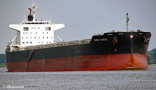
 BOYANG TAURUS
Current Status
Where is the vessel?
BOYANG TAURUS is currently in 105 nm NE of Jarjis, based on AIS data received less than 1h ago.
Latest AIS update:
Current position: 34.85574° N, 9.75804° W (105 nm NE of Jarjis)
Average speed (last 7 days): Loading…
Average speed (last 30 days): Loading…
Vessel profile: BOYANG TAURUS is a Cargo with dimensions m x m.
This page combines live AIS, route history, probable destination signals, nearby traffic, and port activity for practical vessel monitoring.
The current position of vessel BOYANG TAURUS is 34.85574 lat / -9.75804 lng. Updated: 2026-05-17 21:55:47 UTCNearest reference points:
- 112 nm N of El Jadida
- 51 nm NW of Jorf Lasfar
- 44 nm NW of El Jadida
Currently sailing under the flag of South Korea ![]()
Details:
Live Vessel BOYANG TAURUS Analytics (details, animations, etc.)
Recent AIS points (UTC):
2026-05-17 19:30:57 UTC · 35.03724, -9.18538 · SOG 12.5 kn · COG 255°2026-05-17 19:44:39 UTC · 35.02092, -9.23930 · SOG 12.4 kn · COG 255°
2026-05-17 21:55:47 UTC · 34.85574, -9.75804 · SOG 12.4 kn · COG 253°
2026-05-17 21:55:47 UTC · 34.85574, -9.75804 · SOG 12.4 kn · COG 253°