 vesseltracker.com
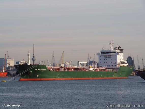
 Atlantic Asphalt
Current Status
Where is the vessel?
Atlantic Asphalt is currently in Near Campana, based on AIS data received less than 1h ago.
Latest AIS update:
Current position: 34.11012° S, 58.98676° W (Near Campana)
Average speed (last 7 days): Loading…
Average speed (last 30 days): Loading…
Vessel profile: Atlantic Asphalt is a Bitumen Tanker with dimensions 160m x 24m.
This page combines live AIS, route history, probable destination signals, nearby traffic, and port activity for practical vessel monitoring.
The current position of vessel Atlantic Asphalt is -34.11012 lat / -58.98676 lng. Updated: 2026-05-16 16:26:44 UTCNearest reference points:
- Near Avellaneda
- Near Dock Sur
- 10 nm NW of San Pedro
Currently sailing under the flag of Marshall Is ![]()
Details:
Live Vessel Atlantic Asphalt Analytics (details, animations, etc.)
Recent AIS points (UTC):
2026-05-16 13:17:53 UTC · -34.11015, -58.98681 · SOG 0 kn · COG 293°2026-05-16 13:26:45 UTC · -34.11024, -58.98688 · SOG 0 kn · COG 293°
2026-05-16 15:23:45 UTC · -34.11013, -58.98680 · SOG 0 kn · COG 293°
2026-05-16 16:26:44 UTC · -34.11012, -58.98676 · SOG 0 kn · COG 293°