 vesseltracker.com
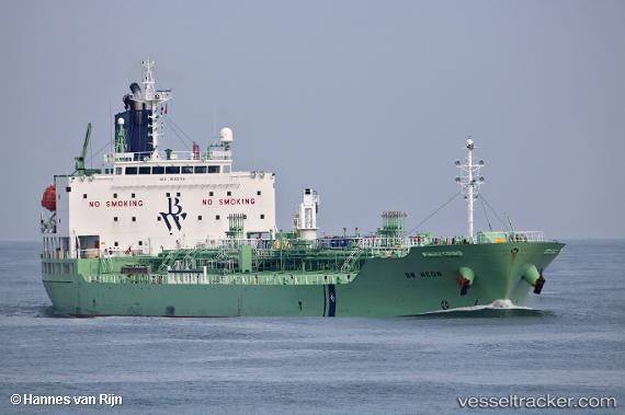
 CHEM NEON
Current Status
Where is the vessel?
CHEM NEON is currently in Near Tottenville, Staten Island, based on AIS data received less than 1h ago.
Latest AIS update:
Current position: 40.52194° N, 74.24986° W (Near Tottenville, Staten Island)
Average speed (last 7 days): Loading…
Average speed (last 30 days): Loading…
Vessel profile: CHEM NEON is a Chemical/Oil Products Tanker with dimensions 147m x 24m.
This page combines live AIS, route history, probable destination signals, nearby traffic, and port activity for practical vessel monitoring.
The current position of vessel CHEM NEON is 40.52194 lat / -74.24986 lng. Updated: 2026-05-16 16:16:10 UTCNearest reference points:
- Near South Amboy
- Near Bayway
- Near Elizabethport
Currently sailing under the flag of Liberia ![]()
CHEM NEON built in 2018 year
Deadweight:
19972 tDetails:
Live Vessel CHEM NEON Analytics (details, animations, etc.)
Recent AIS points (UTC):
2026-05-16 13:46:12 UTC · 40.52197, -74.24986 · SOG 0 kn · COG 200°2026-05-16 13:52:12 UTC · 40.52194, -74.24990 · SOG 0 kn · COG 200°
2026-05-16 15:19:13 UTC · 40.52199, -74.24988 · SOG 0 kn · COG 200°
2026-05-16 16:16:10 UTC · 40.52194, -74.24986 · SOG 0 kn · COG 200°