 vesseltracker.com
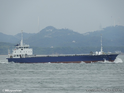
Amakusa
Current StatusWhere is the vessel?
Amakusa is currently in 14 nm W of SUSA, based on AIS data received less than 1h ago.
Latest AIS update:
Current position: 34.67833° N, 131.32333° E (14 nm W of SUSA)
Average speed (last 7 days): Loading…
Average speed (last 30 days): Loading…
Vessel profile: Amakusa is a General Cargo Ship with dimensions 12m x 76m.
This page combines live AIS, route history, probable destination signals, nearby traffic, and port activity for practical vessel monitoring.
The current position of vessel Amakusa is 34.67833 lat / 131.32333 lng. Updated: 2026-05-15 21:42:26 UTCNearest reference points:
- Near Ube
- 39 nm N of Iwami
- Near Tokuyama
Details:
Live Vessel Amakusa Analytics (details, animations, etc.)
Recent AIS points (UTC):
2026-05-15 17:33:29 UTC · 34.06833, 130.85333 · SOG 12 kn · COG -1°2026-05-15 19:39:43 UTC · 34.44163, 130.92757 · SOG 11.8 kn · COG 53°
2026-05-15 19:53:05 UTC · 34.46778, 130.97041 · SOG 11.9 kn · COG 52°
2026-05-15 21:42:26 UTC · 34.67833, 131.32333 · SOG 11 kn · COG -1°