 vesseltracker.com
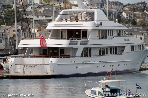
 Teleost
Current Status
Where is the vessel?
Teleost is currently in Near Anuha Island, based on AIS data received less than 1h ago.
Latest AIS update:
Current position: 9.01667° S, 160.12666° E (Near Anuha Island)
Average speed (last 7 days): Loading…
Average speed (last 30 days): Loading…
Vessel profile: Teleost is a Service Ship with dimensions 49m x 49m.
This page combines live AIS, route history, probable destination signals, nearby traffic, and port activity for practical vessel monitoring.
The current position of vessel Teleost is -9.01667 lat / 160.12666 lng. Updated: 2026-04-25 09:20:36 UTCNearest reference points:
- 36 nm W of Selwyn Bay
- 38 nm SW of Selwyn Bay
Currently sailing under the flag of Cayman Is ![]()
Teleost built in 1998 year
Details:
Live Vessel Teleost Analytics (details, animations, etc.)
Recent AIS points (UTC):
2026-04-25 05:59:39 UTC · -9.01667, 160.12500 · SOG 0 kn · COG -1°2026-04-25 07:05:38 UTC · -9.01667, 160.12666 · SOG 0 kn · COG -1°
2026-04-25 08:02:38 UTC · -9.01667, 160.12666 · SOG 0 kn · COG -1°
2026-04-25 09:20:36 UTC · -9.01667, 160.12666 · SOG 0 kn · COG -1°