 vesseltracker.com
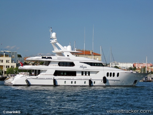
 Amica Mea
Current Status
Where is the vessel?
Amica Mea is currently in Near Rivera Beach, based on AIS data received less than 1h ago.
Latest AIS update:
Current position: 26.75093° N, 80.04985° W (Near Rivera Beach)
Average speed (last 7 days): Loading…
Average speed (last 30 days): Loading…
Vessel profile: Amica Mea is a Service Ship with dimensions m x m.
This page combines live AIS, route history, probable destination signals, nearby traffic, and port activity for practical vessel monitoring.
The current position of vessel Amica Mea is 26.75093 lat / -80.04985 lng. Updated: 2026-05-18 07:01:27 UTCNearest reference points:
- Near Rivera Beach
- Near Palm Beach
- Near Lake Park
Currently sailing under the flag of Cayman Is ![]()
Amica Mea built in 2004 year
Deadweight:
75 tDetails:
Live Vessel Amica Mea Analytics (details, animations, etc.)
Recent AIS points (UTC):
2026-05-18 04:25:24 UTC · 26.75093, -80.04984 · SOG 0 kn · COG 89°2026-05-18 04:40:27 UTC · 26.75093, -80.04984 · SOG 0 kn · COG 88°
2026-05-18 06:04:24 UTC · 26.75096, -80.04985 · SOG 0 kn · COG 86°
2026-05-18 07:01:27 UTC · 26.75093, -80.04985 · SOG 0 kn · COG 86°