 vesseltracker.com
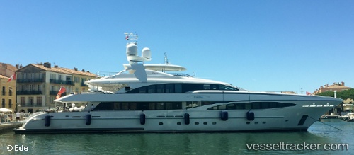
 Yalla
Yalla
Current Status
Where is the vessel?
Yalla is currently in Near Cannes, based on AIS data received about 1h ago.
Latest AIS update:
Current position: 43.54079° N, 7.03153° E (Near Cannes)
Average speed (last 7 days): Loading…
Average speed (last 30 days): Loading…
Vessel profile: Yalla is a Service Ship with dimensions 47m x 8m.
This page combines live AIS, route history, probable destination signals, nearby traffic, and port activity for practical vessel monitoring.
The current position of vessel Yalla is 43.54079 lat / 7.03153 lng. Updated: 2026-05-13 23:54:56 UTCNearest reference points:
- Near GOLFE JUAN
- Near Juan-les-Pins
- Near Golfe-Juan
Currently sailing under the flag of Cayman Is ![]()
Yalla built in 2004 year
Deadweight:
113 tDetails:
Live Vessel Yalla Analytics (details, animations, etc.)
Recent AIS points (UTC):
2026-05-13 19:57:57 UTC · 43.54079, 7.03151 · SOG 0 kn · COG 112°2026-05-13 21:51:56 UTC · 43.54078, 7.03152 · SOG 0 kn · COG 112°
2026-05-13 22:57:57 UTC · 43.54078, 7.03150 · SOG 0 kn · COG 111°
2026-05-13 23:54:56 UTC · 43.54079, 7.03153 · SOG 0 kn · COG 112°