 vesseltracker.com
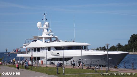
 SWEET MARYI
Current Status
Where is the vessel?
SWEET MARYI is currently in Near PERAMA, based on AIS data received less than 1h ago.
Latest AIS update:
Current position: 37.96251° N, 23.57103° E (Near PERAMA)
Average speed (last 7 days): Loading…
Average speed (last 30 days): Loading…
Vessel profile: SWEET MARYI is a Yacht with dimensions m x m.
This page combines live AIS, route history, probable destination signals, nearby traffic, and port activity for practical vessel monitoring.
The current position of vessel SWEET MARYI is 37.96251 lat / 23.57103 lng. Updated: 2026-05-14 23:58:48 UTCNearest reference points:
- Near PERAMA
- Near Keratsínion
- Near Drapetzona
Currently sailing under the flag of Malta ![]()
Details:
Live Vessel SWEET MARYI Analytics (details, animations, etc.)
Recent AIS points (UTC):
2026-05-14 19:46:53 UTC · 37.96246, 23.57106 · SOG 0 kn · COG 183°2026-05-14 21:34:58 UTC · 37.96248, 23.57106 · SOG 0 kn · COG 183°
2026-05-14 22:40:47 UTC · 37.96251, 23.57106 · SOG 0 kn · COG 183°
2026-05-14 23:58:48 UTC · 37.96251, 23.57103 · SOG 0 kn · COG 183°