 vesseltracker.com
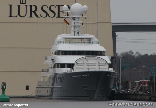
Rocinante
Current StatusWhere is the vessel?
Rocinante is currently in Near HARLINGEN, based on AIS data received about 5d ago.
Latest AIS update:
Current position: 53.18980° N, 5.42728° E (Near HARLINGEN)
Average speed (last 7 days): Loading…
Average speed (last 30 days): Loading…
Vessel profile: Rocinante is a Service Ship with dimensions 14m x 78m.
This page combines live AIS, route history, probable destination signals, nearby traffic, and port activity for practical vessel monitoring.
The current position of vessel Rocinante is 53.18980 lat / 5.42728 lng. Updated: 2026-05-09 15:07:51 UTCNearest reference points:
- Near HARLINGEN
- Near FRANEKER
- Near Wonseradeel/Makkum
Details:
Live Vessel Rocinante Analytics (details, animations, etc.)
Recent AIS points (UTC):
2026-05-09 15:07:51 UTC · 53.18980, 5.42728 · SOG 0.3 kn · COG -1°2026-05-09 15:07:51 UTC · 53.18980, 5.42728 · SOG 0.3 kn · COG -1°
2026-05-09 15:07:51 UTC · 53.18980, 5.42728 · SOG 0.3 kn · COG -1°
2026-05-09 15:07:51 UTC · 53.18980, 5.42728 · SOG 0.3 kn · COG -1°